The Pacific Northwest
We actually had one more week in California before heading to Oregon and then Washington, and this last week in California was so much fun. We camped in a small coastal town called Marina, near Monterrey, and got to see our friends who live locally, drive Hwy 1, and visit plenty of charming beach towns.


 This monument in the square at Cannery Row featured several statues of people enjoying various activities at the coast.
 Cannery Row is right next to the ocean.


 The entrance to the cave from the inside


After Bend, we headed to our next campground in the Mount Hood area, located in the northwestern part of the state. This stay had more history-based activities than the last few, and fascinating history at that--the Oregon Trail! Just down the road from our campground was Oregon City, the official end of the Oregon Trail.


 An Oregon Trail mural in one of the towns near Oregon City


 Inside the twin tunnels!


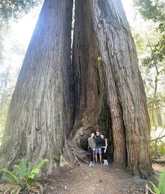
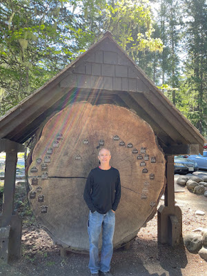
 The World's Largest Sitka Spruce Tree is located just outside of Olympic National Park-- and it is huge!


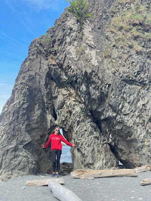


 It was low tide when we were at Shi Shi Beach, and the jagged exposed rocks made for an eerie scene.


 The Space Needle! We didn't go up into it cuz it was super overpriced, but that didn't stop us from hopping on the monorail from downtown and going to see it!


 This was seriously one of the biggest cinnamon rolls I have ever had in my life (tied with the giant cinnamon rolls at Gaston's Tavern in Disney's Magic Kingdom)


The sunset on our first night

We walked around Cannery Row in Monterrey, a pretty shopping and dining area that used to be the location of sardine canneries.


Pretty flowers on Cannery Row!

My mom cashed in the coffee and pastry coupon Mia gave her for Mother's Day at a cute creperie.


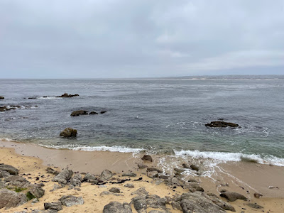
Driving around Pacific Grove, the town next to Monterrey, we got to see some pretty coastline.

There was an authentic and very neat Turkish sweet shop on Cannery Row, and my mom bought us some Turkish delight--my Narnia fans, this is for you! I used to love Narnia when I was a kid and in the book, Turkish delight is a pretty important food--after all, Edmund betrays his family to the White Witch for more of the stuff.


We went to a state park along Hwy 1 and this stop was one of my favorites the whole day--which is saying a lot, cuz we did some super-fun and awesome stuff that day. We did a trail along the ocean and I got a free pamphlet that told about the flowers you could see along the trail. I had a fabulous time finding all the different flowers and learning their names--yes, I know I'm such a nerd. 😆


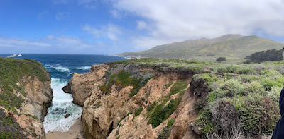
The California coast really is stunning


We climbed up one of the hills bordering the road, and let me just say I loved the rolling green mountains right at the coast on this drive, and the rainbow of wildflowers growing everywhere.

The landscape reminded me of a Caribbean island--lush mountains and sea, right at one another.


A back view of Bixby Bridge, the famous Big Sur bridge

Can't believe we were here!

These waters looked Mediterranean in their turquoise clearness


Julia Pfeiffer State Park was where we got to see the famous waterfall on the beach (see below in the left-central part of the photo)


The Santa Cruz Boardwalk! It was like being at high school here, the majority of visitors were teenagers. 😅 It had a good family-friendly vibe and my mom, Mia and I rode the Big Dipper wooden roller coaster on the left side of this photo. It was a lot of fun, and extra special since the coaster's centennial was this year! Since it's opening in 1924, there's been over 68 million riders--and now we've added to that number!


These colorful houses in Capitola Village near Santa Cruz were very Cali-beachy.

We got to see elephant seals on a beach in a state park near Santa Cruz. They come here to molt (at this time of year they were losing their baby fur) and they were so funny, laying on the sand and flopping their blubbery bodies up and down the beach.

Shark Fin Cove

Down in the cove. The rock looked more like a shark fin from up top 😆

This natural arch down in the cove was so neat!

We thought these unique blooms looked like bottlebrushes

Snazzy ride

Fairytale cottages are a thing in Carmel-by-the-Sea that just add to the seaside town's charm. The first cottage was built in 1924 by Hugh Comstock, who came up with the idea for his wife's doll-making business. The idea caught on, and nearly thirty more cottages were built by the late 1920s. Many of the homes today are occupied by locals, as indicated by the car in the driveway of the cottage above.


The shopping and dining scene in Carmel is upscale and diverse, great for a romantic weekend getaway.

I love finding pretty little alleys downtown--they're great for photos with Mia.


The garden in front of this house on one of the quiet streets tucked between downtown Carmel and the beach reminded me of something from Alice-in-Wonderland.

We got donuts at a downtown spot that had unique flavors like chai (which we tried, and it was very good)

Playing at the beach in Carmel

We went to a cool recycle and plant coffee shop one morning; it had a fun and eco-friendly vibe

An intense battle of foosball in the campground game room

Campfire at our RV

These plants (my great-grandma used to call them hen-and-chicks) were so big!
Our week in Marina, California, was full of wonderful, memorable experiences; and I hope we get to visit California and our friends again in the near future!
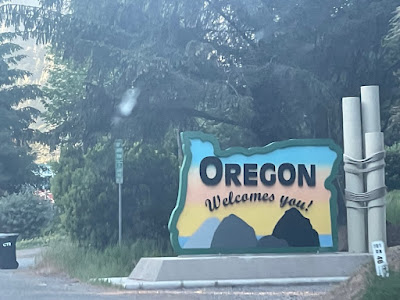
Now we were headed to Oregon, where we would be for the next four weeks. As we were driving to our first campground in Oregon, we crossed the Golden Gate Bridge! We stopped at a pullout to take pictures with it, and our RV was quite the attraction--people were actually taking pictures with it. 😂


We visited Redwoods National and State Parks at our first Oregon campground in the town of Brookings.

Hiking through Tall Trees Grove


We also got a permit to go to Fern Canyon, probably one of the most well-known spots in the Redwoods. Feathery green ferns cover the natural rock walls, and multiple wooden footbridges cross the river running through the canyon. I've been looking forward to coming here for over a year, and I'm grateful we got the opportunity to see it!


Samuel H. Boardman Scenic Corridor was a seaside drive with beaches, hikes, and coastal forest. We really enjoyed this route, and I definitely recommend spending a couple days exploring it if you are ever in the area.

The tall rock pillars in the ocean are called seastacks, and there's a lot of those on the Pacific Northwest coast.


We hiked up from the beach to a grassy knoll with great 180 degree views of the surrounding coastline and vast ocean.


At low tide, the rocks were covered with mussels and barnacles that made audible clicking sounds that were a little bizarre but also cool.


We went tidepooling at one of the beaches and it was INCREDIBLE! The green-tentacled creatures are sea anemones, and of course you recognize the starfish.


My mom doing the Little Mermaid pose


Sea lions chilling at the water's edge (center of photo)


I can't remember the name of this lighthouse on the Samuel H. Boardman Scenic Corridor, but it just so happened to be located at the windiest place on the whole West Coast. The wind was WILD here.

The beaches in Oregon reminded me of Maine's coastline; in the way that the forests grow right up to the water's edge.

On nearly every beach we visited in Oregon, there were rivers that ran down the beach into the ocean. I hadn't seen this a ton before, and it was pretty neat to see.

At low tide, this little cove was accessible!

My mom and Mia went out just the two of them one day, and they had a great time!


The misty redwood forest...


Our second week in Oregon was spent at a campground near Bend, Oregon. We were surrounded by huge, blue, white-capped mountains our whole stay here, and we got to visit Crater Lake National Park, go waterfall-chasing, explore a lava tube cave, and much more!

The Cascade Lakes are a chain of pristine mountain lakes with a backdrop of beautiful snow-topped mountains. We drove the loop to see several of the lakes one day, and it was crazy how even in June there was still several feet of snow on the ground here.

The weather was so warm we could simply trek through the snow in shorts and T-shirts.

We hiked out to one of the lakes, Todd Lake, and it was still partially covered with snow!


Bend is home to the world's last blockbuster store. My parents enjoyed the nostalgia of the store, and I thought it seemed like a neat concept--dozens of DVDs in all genres available for rent.

Lava River Cave in Deschutes National Forest was only a few minutes from our campground, and such a unique experience. I don't completely understand the process of how it was formed (sorry, they don't like to give explanations in plain English 😂), but the caves were created by solidified lava, making them smooth on the inside whereas regular caves usually boast a large assortment of jagged stalactites and stalagmites.


See what I mean about the smooth ceiling of the cave? Sometimes it felt like we were walking through secret tunnels deep beneath a city.

There was also no light source inside the cave other than the flashlights visitors bring with them. A few times my family and I would pause when there wasn't anyone in front of or behind us for a little ways, and turn off our flashlights just to experience the pitch darkness.

What a view!

Lava chunks from the famous local volcanic explosion litter the ground of the national forest. The picture above is from one of the hikes we did, and it was inspired by Mia saying something about my dad looking like a prairie dog sometimes, the way he'll stand up on a hill and gaze at his surroundings. 😆

In one area of the national forest you can see 'vases'-- formations where lava cooled around trees now rotted away. The lava, like a cast, still holds the shape of the tree it once encircled.

See how the landscape on this hike was just covered with the lava rocks?

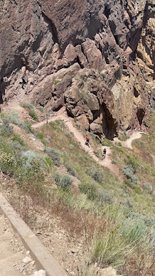
Misery Ridge Trail in Smith Rock State Park was...kinda miserable--BUT totally worth it. We just happened to be hiking in the midday sun, and it was uphill the whole way. But the views...stunning!

The trail

Ta daaa! Wait till we get to the photos from the top. 😉

Disclaimer--the photo above isn't Misery Ridge trail. We actually combined that trail with this second one to see more of the state park and have less of a climb on our way back.

See what I mean about the views on Misery Ridge?


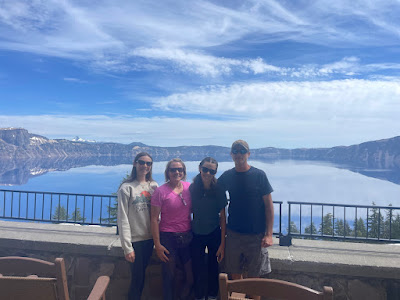
This was one of the coolest days we had at our Bend campground. We went to Crater Lake National Park first, which exceeded my expectations. The vast blueness of the lake and the rim of mountains that reflected in its still surface were picture-perfect.


Part of the road wasn't open in the park, so we walked a portion of it and as you can see, the snowbanks here were massive, especially for the time of year.

Wizard Island is one of two islands in Crater Lake, but is probably the most famous and recognizable of the two.

ONTO THE WATERFALLS! If you don't know this already, I am a fan of waterfalls. We visited several the same day we went to Crater Lake National Park, and my favorite was the one above--Watson Falls. It's the third-highest waterfall in Oregon!

Watson Falls was so powerful that we were thoroughly covered in spray by the time we left.
Downstream of Watson Falls was yet another waterfall--less powerful, but still gorgeous.

This one reminded me of a tropical cascade in somewhere like South America.

Clearwater Falls

Toketee Falls is really well-known, but I actually preferred some of the other waterfalls that you could get closer to.

Umpqua Hot Springs was something I'd seen on blogs to do in the area, and it was neat but...we wouldn't go back. Though these springs were undeniably unique--perched on ledges overlooking the Umpqua River below--the water was pretty silty and left us feeling kinda dirty.

We went to the cute small town of Sisters another day and visited some friends we'd met two years ago while we were at Yosemite National Park. We enjoyed a chill day strolling downtown and sampling local deserts. We also went to a cute little museum where we got to sit in a real-life limo for the first time!

Mia, the refined young celebrity in her limo. 😉

On the same day that we went to Sisters, we also explored the nearby Skylight Caves. This underground cavern has gaps in the ceiling where sunlight shines through at certain times of day, giving a spotlight effect.


Probably the cutest experience we had during our week in Bend was at an alpaca farm. Their chubby cheeks and long eyelashes were aww-inducing.

As if it couldn't get any cuter--THERE WERE BABIES! The moms and babies were matching colors.


Behold the peaceful scene...


After Bend, we headed to our next campground in the Mount Hood area, located in the northwestern part of the state. This stay had more history-based activities than the last few, and fascinating history at that--the Oregon Trail! Just down the road from our campground was Oregon City, the official end of the Oregon Trail.

The End of the Oregon Trail Interpretive Center was a great interactive museum that gave the history from start to finish of the Oregon Trail. There was background on the preparation for the journey, the dangers and hardships settlers experienced, firsthand accounts written by actual people who had taken the Oregon Trail, and even some history on the native people of the area. I'm a history buff, so we spent a good few hours here, and it was definitely a highlight of our stay in Mt. Hood!

We got to hand-dip our own candles just like the settlers would have!

In the picture Mia's holding the candle she made and I'm holding the land grant I filled out.

You could pack your own wagon with all the staple provisions for the 5-6 month journey--oats, flour, sugar, vegetables, and meat--but don't pack too much, the oxen can only pull up to 2500 pounds, and you have to fit all your personal belongings in there too! It was actually kinda crazy how quickly everything added up.

We petted a bison head--his name was Hank. Pioneers on the Oregon Trail encountered millions of bison on their journey across the Midwest, and they used the huge beasts' dried poop (referred to as 'buffalo chips') as fuel for their campfires.


We got to drive part of the trail, a section called Barlow Road that served as a toll road. The Oregon Trail in total was 2000 miles long and settlers would leave in the spring so that they would be set to arrive at the end of the route in Oregon City before winter. It is estimated that about 300,000 to 500,000 people traveled the Oregon Trail.


Coffee and flower break!! So, Dutch Bros is a popular drive-thru coffee chain that I had never tried, and they're especially popular in the Pacific Northwest. We decided to sign up for their app and actually got a free medium coffee just for signing up! I ordered the Irish Kicker, and boyyy was it good!


Okay, back to the scenery and history. 😉
Willamette Falls in the center of the photo was a popular spot for local Native Americans who came here to catch salmon. Today it is used for hydroelectric power.

Jonsrud Viewpoint, with the dramatic peak of Mount Hood in the distance.

We spent one full day exploring the famous Columbia River Highway. This scenic drive has plenty of viewpoints, waterfalls, and hikes.

We did a hike that was about 6 miles long and were able to see several waterfalls, including the one above whose name I forgot. 😂

The famous Multnomah Falls!

We got on the bridge crossing Multnomah Falls and my mom stayed below to take a picture of the three of us.

The Mt. Hood Fruit Loop was another fun day. The Fruit Loop is a drive with over thirty stops at local wineries, farms, and country stores where you can purchase fresh fruits and baked goods, sample cider and wine, and enjoy the beautiful views of Mount Hood looming above it all. We obviously didn't do all thirty stops, but we felt like we got a good taste of what the Fruit Loop had to offer--both literally and figuratively. 😉

Our first stop, Draper Girls Country Store, had a swing in the backyard of the store and Mia and I had to try it out.

More flowersss!

My favorite stop we made was at Hood River Lavender Farm. I'd been wanting to visit a lavender field, and the day had come! We purchased some lavender essential oil in the gift shop, then went out to take some pictures in the fields before settling down to enjoy lavender ice cream and lemonade. What a cool experience!


My parents did a cider tasting at the Gorge White House, one of the more popular stops along the Fruit Loop

There's something so wholesome about being surrounded by orchards, isn't there?
We also stopped at a winery, and I noticed that there were roses planted at the ends of the vineyard rows. Curious, I googled it and it turns out that the roses act as a warning system--like a miner's canary--to protect the grapes from diseases and pests. The roses get infected first because they are more delicate.

See what I mean about the roses at the end of the rows? Also, the house in the background was private property, but isn't it just lovely? I didn't really know this about myself before we started RV-ing, but it turns out I am a fan of architecture--who knew?

Another vineyard. 🍇

To end our day on the Fruit Loop we took a paved path up above the Columbia River to a pair of covered tunnels. This was a really nice walk actually, and there were beautiful cornflowers in various hues as well.

Mia and I enjoy weaving flowers we find on hikes into each other's hair.

Not a bad view of the Columbia River huh? And on the other side of the river is Washington state!


Our last activity at this campground was spent at one of the most famous--or should I say infamous-- attractions in the area. Timberline Lodge! The exterior of this ski lodge was featured in Stephen King's movie, The Shining.


We ordered a big hot chocolate and some fresh artisan bread in the lodge's restaurant, and it was delicious. It was actually quite a bit colder up on the mountain where Timberline Lodge is located, versus down the mountain where our campground was; so the warm food and drinks were extra enjoyable.
Our last destination in Oregon was Seaside, a touristy coastal town in the northwestern tip of the state. Like the previous three stays, we were here for a week, and during that time we enjoyed some history (Lewis and Clark, anyone?), beach time (of course), and local culture.


We got to visit the local farmers market, which had a pretty good assortment of wares We bought blackberry honey straight from a beekeeper, purchased some fresh cherries, and enjoyed French crepes. Is your mouth watering yet? 😉

One unique activity Seaside offered was a beach cleanup project where visitors can go get bags and gloves from the local aquarium then head out to the beach to pick up trash. Once your bag is full, you're rewarded with a five dollar credit to be used at participating coffee shops in town.


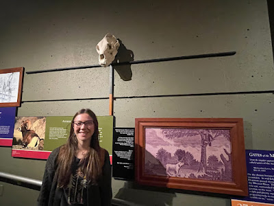
Lewis and Clark's 1804 expedition to explore the Louisiana Territory ended near the town of Astoria, OR, not far from our campground in Seaside. It was pretty cool to be somewhere where such important history was made--especially since, two years ago, we'd been in St. Louis, where the expedition party set off. To learn some more about Lewis and Clark's history-making journey, we drove across the Columbia River to Cape Disappointment, Washington, and visited the Lewis and Clark Interpretive Center.

Cape Disappointment Lighthouse

This grizzly bear skull is placed at the height an adult grizzly bear standing on its hind legs would be at. The horizontal black pole right below the skull is the length of a grizzly's outstretched arms.

Deadman's Cove at Cape Disappointment was named after dead sailors washed ashore here from a shipwreck in 1853. It was actually a very pleasant little beach.

Astoria Column is a unique tower covered in detailed artwork depicting the history of the region; from the discovery of the Columbia River in 1792, to the arrival of the railroad in Astoria in 1893. The painting style used on the column is called sgraffito-- scenes are inscribed into wet plaster and then the artist hand-blows colorful powders into the profiles. Pretty neat, right?

The 360 degree views at the top of the column were great--the picture above is just one of the directions!

My beautiful mommy 😚

We got up early one morning to go beachcombing for sand dollars, and we found three! The way to know a sand dollar isn't still alive (if it is alive you shouldn't take it of course) is to check if they have a velvety feel or are dark gray in hue. When sand dollars die, the hairs that make them feel velvety fall off, and they are bleached white by the sun.

We drove the Three Capes Scenic Route southward to Tillamook one day, and it was a nice coastal drive. The tree in the picture above is called Octopus Tree, and it's a single Sitka spruce tree that has branched out to have what looks like multiple trunks.


We took a short but sweet tour of Cape Meares Lighthouse, the smallest lighthouse on the Oregon Coast.

This beach at Cape Kiwanda was actually vehicle--accessible, and dozens of people had driven their cars and trucks down for a beach day and cookout. Can you see all the tire tracks in the wet sand?

Check out these beautiful flowers!

Another beach waterfall

Something about the foggy beach was so mysterious and intriguing.

Haystack Rock at Cannon Beach, which was actually used as a filming location for the 1985 movie The Goonies.

The mountainous coastline at Cannon Beach

The tiny Tillamook Lighthouse, nicknamed 'Terrible Tilly' for the severe storms that raged around the island-bound lighthouse.

Not sure where we took this sunset photo, but isn't it pretty?
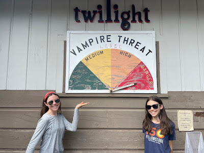
Our time in Oregon was over, but our time in the Pacific Northwest was not! We would be spending the next six weeks in Washington State, and our first campground was in none other but Forks, Washington! For those of you who have read Twilight, you'll remember this town as the setting for the popular book and movie series. Mia and I actually watched movies 1&2 for the first time here, and we loved them. It really added to the experience of being in this region of Washington.

First beach in La Push is where Bella and her friends from school go for a beach day. It's also where Bella re-meets her best friend, Jacob Black.

Port Angeles is where Bella and her friends go shopping for prom dresses in the first Twilight book.

Lovely flowers at Port Angeles' harbor front walk

A pretty little area in downtown Port Angeles

Edward and Bella's first date takes place at a small Port Angeles restaurant called La Bella Italia--so of course we had to stop by here for a meal! My mom got the mushroom ravioli that Bella orders in the book (see picture below).


Bella's part-time workplace in the books.

The treaty line set by the local Quiluete Indians, barring the vampires access past this point. Of course this isn't a real-life boundary line, just a Twilight reference--but it was awesome to see how the locals had embraced the popular series.


We did a self-guided tour around Forks of Twilight spots (from the books, not the movies), such as the Cullen House, where Edward Cullen and his vampire family resided. The Cullen name is still on the mailbox at the house, which is now a bed and breakfast.


The high school where Bella and Edward met!

Charlie Swan's cop car (in case you don't remember, or have never read the series, Charlie is Bella's dad).
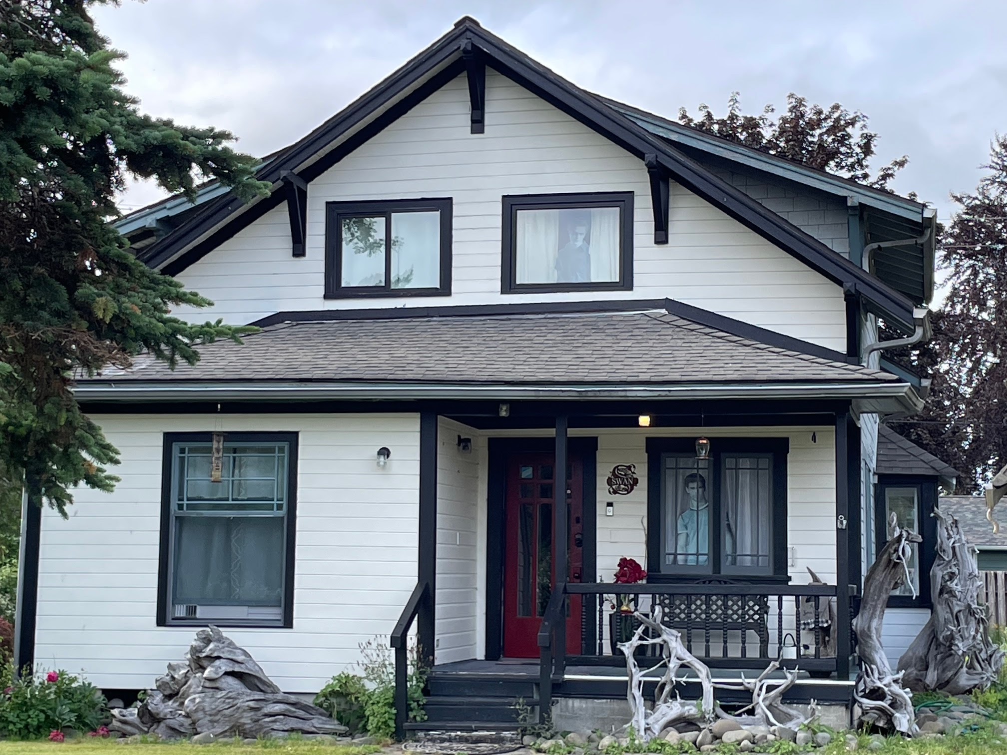
Bella Swan's house

As we were walking around doing the Twilight tour, we noticed some trees with very unique spiky needles.

More interesting fauna I noticed on our tour! These flowers made me think of Alice in Wonderland.
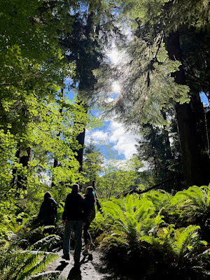
We spent a good portion of our time in the nearby Olympic National Park, which is exactly what you think of when you think 'Pacific Northwest.' Wet, foggy, lush and green, this national park was a gem. Besides the flourishing rainforest regions of the park, there were also stretches of coastline, lakes, and the majestic peaks and ridges of the Olympic Mountain range.


Sol Duc Falls is the most famous waterfall in Olympic National Park


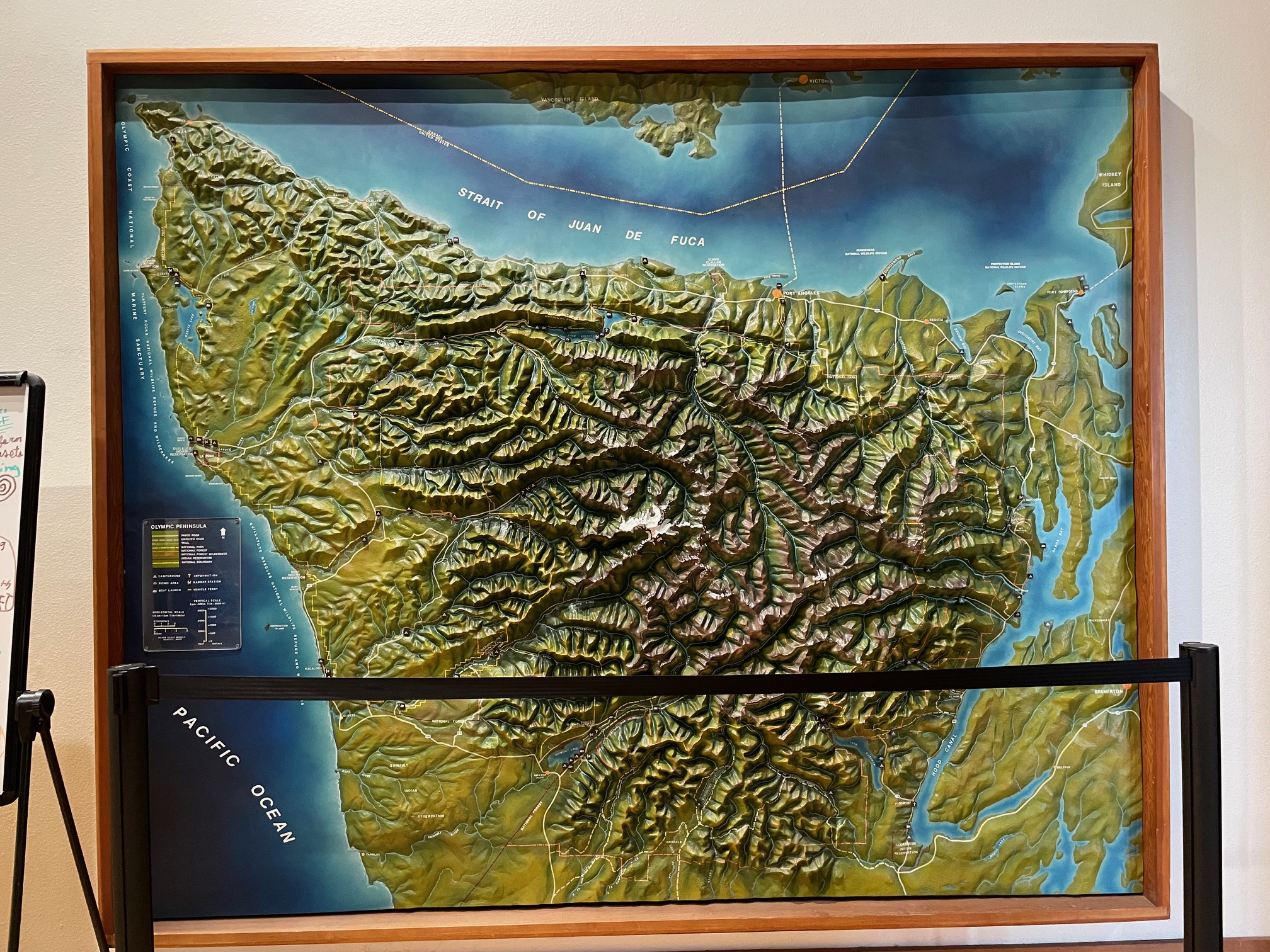
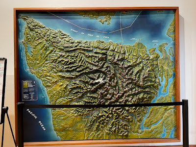
Topographical map of the Olympic Peninsula, the area of Washington state where Olympic National Park is located.


When a tree falls in the rainforest here, its usefulness is not over. The dead tree provides nutrients that allow new trees to grow. When the dead tree--called a 'nurse tree' for the way it sustains the saplings that take root in it--rots away, the roots of the trees that grew on it remain arched up in the air like in the picture above.

We saw a few deer while we were in the park, and we even got to see some adorable fawns (I didn't get a picture).

THE SUNSHINE! It was scarce during our week here, so when it shone, we appreciated it.

This stream in the Hoh rainforest was so clear--the green weeds growing on the bottom are perfectly visible.

Raindrops on the leaves


Lake Crescent is the largest lake in Olympic National Park


Lake Crescent again--the water here was super clear as well.

Hurricane Ridge trail made you feel like you were in Switzerland.


Alpine flowers


We saw eagles on Rialto Beach!

Hole-in-the-Wall, a natural arch on Rialto Beach.


As we were walking back down the beach from Hole-in-the-Wall, some seals came close to the shore and poked their heads up to watch us. It was cute, like they were intrigued by us.

A speckled banana slug!

Another natural arch, though admittedly smaller and less impressive than Hole-in-the-Wall. This arch was located on Ruby Beach, one of the most visited areas of Olympic National Park.

The Tree of Life is a spruce that is suspended in the air by its roots.

Cape Flattery is the northwestern most tip of the continental US, and it's on tribal land so it's not a part of the national park. We got to see some beautiful scenery here, but it was also probably the coldest day of our stay in Forks.

To cope with the cold weather, my mom brought a thermos of tea and drank it as we hiked.


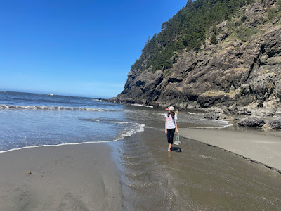
Tidepools at Shi Shi Beach, our second stop at Cape Flattery.

Our next spot was in Packwood, right outside of another Washington National Park--Mount Rainier! We were here during the Fourth of July so it was pretty busy (and hot); and on July 6 we went to watch a local fireworks display that was pretty impressive--about 45 minutes long.

Welcome to America's fifth national park!

Reflection Lake, with Mount Rainier on full display.

Narada Falls


Christine Falls was beautiful, spilling into water-carved 'bowls' of rock.


Myrtle Falls


3D topographical map of Mount Rainier National Park


We saw a marmot on one of our hikes!


The closest we got to Mount Rainier was probably in the Sunrise region of the national park.

Glacial lake

Just a couple hours away from our campground was Mount St. Helens National Volcanic Monument. We spent the day here exploring the area and learning about the famous 1980 eruption and its aftermath.

At the Forest Learning Center we got to touch some of the ash from the eruption. It wasn't smooth and fine, the way I expected it to be; and the center's staff explained that the abrasive texture made the ash even more detrimental for the health of those who happened to breathe it in. In fact, most people and animals killed during the eruption died from suffocation by inhaling the ash, which was mainly comprised of natural glass particles. The ash spread as far as Denver, Colorado; 1000 miles away.

Contrasting photos of Mount St. Helens nearly two decades before, and then during the eruption on May 18, 1980. An informative panel explained that small earthquakes began on Mount St. Helens in March of 1980, and by the end of the month they were occurring with alarming frequency--one per minute. The quakes hinted to the magma heaving up inside the volcano. A new crater had also formed on the mountain's summit, issuing steam and ash. The crater grew to a size of 1200 feet across and 500 feet deep in April; and on the mountain's northern slope a lump began to form, again hinting to the magma being forced up into Mount St. Helens' core. The lump is thought to have been over a mile wide and more than 300 feet high right before the eruption.

57 people died in the Mount St.Helens eruption, and the helicopter blades of rescue operations blew the ash around, making it extra difficult to perform their duty.

The blast was so intense that in the zones 6-14 miles away, the 600 degree cloud of gas and debris that erupted from Mount St. Helens knocked down trees and stripped them of bark and branches; like in the picture of the log cross section above.
We left our campground outside of Mount Rainier after a week, and moved to a coastal campground in the little town of La Conner. During our time here we went to a nearby state park called Deception Pass, rode the ferry to the San Juan Islands, and took a day trip to Seattle.

We got up before the sunrise to board the ferry.

On the ferry, heading to the San Juan Islands! There are 175 named islands that make up the San Juan islands, and we visited two on our day trip--Orcas and San Juan.
San Juan Island (pictured above) had more of a quiet, undeveloped coastal feel to it, while Orcas Island boasted mountains, forests, little villages, and more of a festive feel.

This hotel on San Juan Island was built in the 1800s!

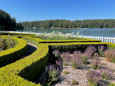
Mia loves the bushes trimmed into shapes.

The view from the top of Mount Constitution, the tallest peak on all the San Juan Islands. Its elevation is only 2399 feet.

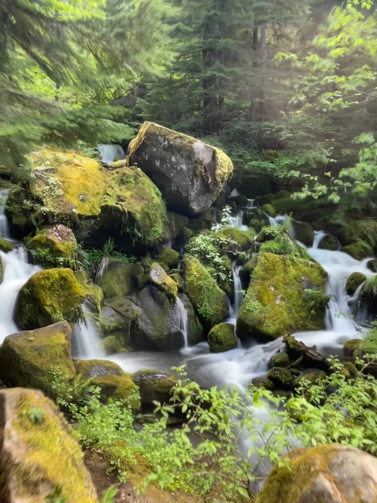
We did a short and sweet waterfall hike.


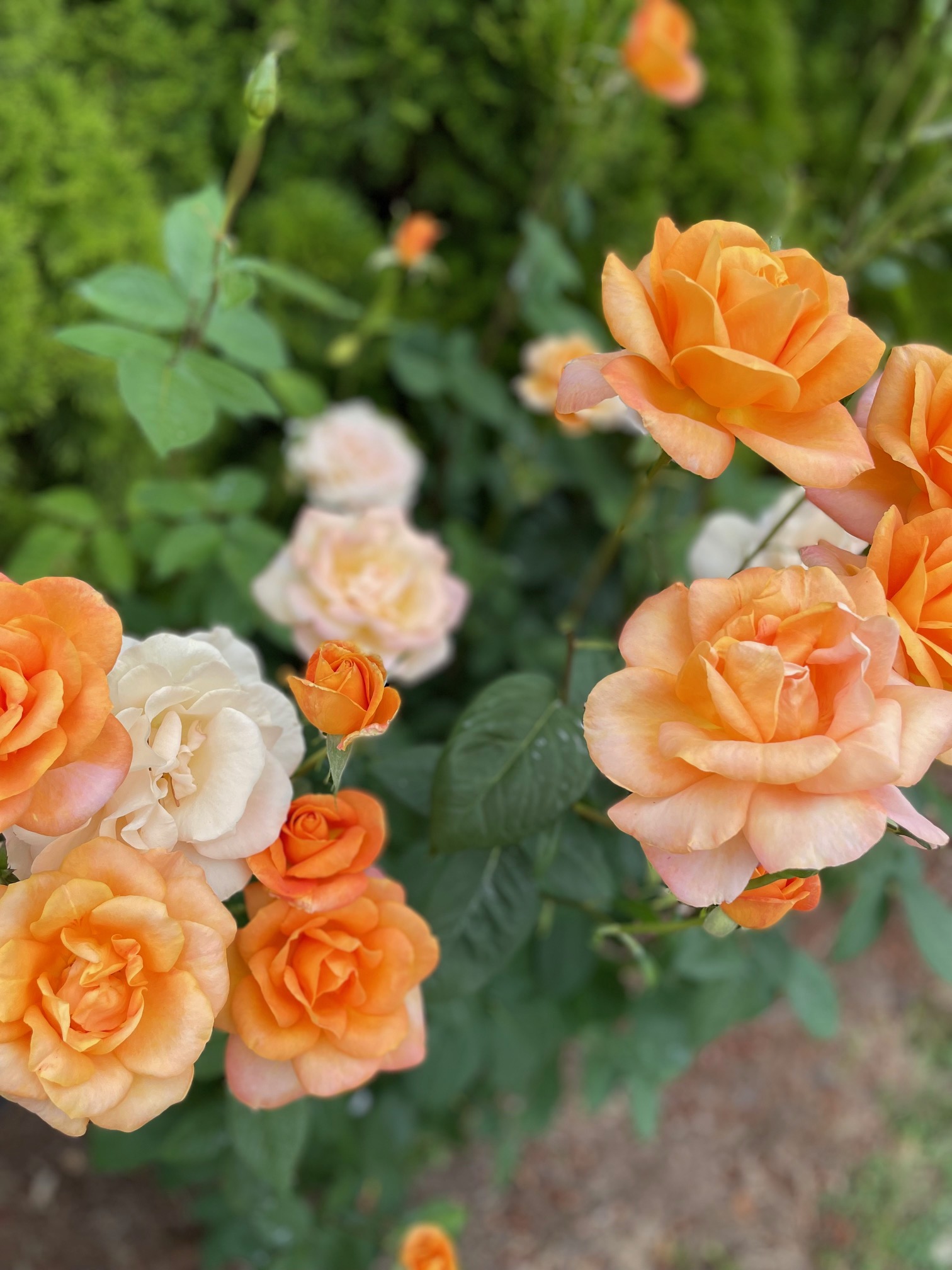
The flowers on the islands were plentiful, with many different varieties and colors.


Lime Kiln Lighthouse on San Juan Island

Welcome to Seattle! We went to the first Nordstrom store and didn't even know it--but here it is!


Some abstract art in the park near the Seattle Space Needle.

Pike Place Market is a destination at the top of every Seattle bucket list. Sprawling out to encompass nine acres, the market opened in 1907 and holds the place as one of the longest continually operated public farmers markets in the United States. Everything from souvenirs and fresh fish to international food stalls and local produce are sold here; and we spent a few hours browsing this historic Seattle destination.


Mia and I got lunch from one of the Asian food stands, and the unique flavors and textures of the foods were so fun.

Inside the market. It was actually way busier than this photo portrays,which may partly have been due to the fact that we visited around lunchtime.

Deception Pass State Park's signature landmark is its two-lane bridge.

We did some hiking at the state park.

I (somewhat) caught my family off-guard with this photo 😆
Our next campground was semi-close to North Cascades National Park, and we got in some nice hiking here. There was actually a fire in the park that prevented us from doing one of the hikes we had planned--Washington's dry season is July through August--but that was okay, because we went to the visitors center for more info on the fire and found out another hike we'd wanted to do wasn't snow-covered like we'd previously thought! So we switched plans and did that hike instead--and it was beautiful!


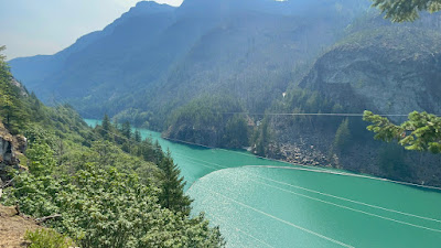
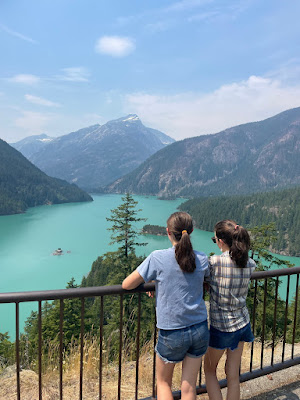
The lakes in North Cascades National Park have a lovely turquoise tint to them. This is caused by the sunlight hitting the glacial flour (rock dust created by glaciers sliding over mountains) that is in the water.


The reason these tree trunks are bowed is due to something called a snow creep. In the winter when snowbanks begin to 'creep' downhill, the weight of the mass of snow causes the trees standing in their way to bend, warping the trunks.

The waterfalls cascading down the steep banks of the mountains into this glacial lake are so beautiful, right?


Welcome to the adorable Western town of Whittier, right outside of North Cascades!


We left North Cascades National Park on July 21, and our next campground was right outside of the adorable Bavarian town of Leavenworth, Washington.

The day we got to our Leavenworth campground, we decided to go downtown and do some exploring. We had a fun time, and just kept taking pictures of the German architecture--it was so cute! Leavenworth reminded me of a bigger Frankenmuth, Michigan; which we visited last fall during the beet harvest.


We had a mini food tour in Leavenworth too, starting at this cute gingerbread shop! Above is a picture of the espresso choc cookie we had (so good, like seriously an extra yummy cookie)


And of COURSE we had to get a lil gingerbread man.


The foyer of one of the little bakeries.

Munchen Haus is a must-visit on every Leavenworth visitors guide. We enjoyed a pretzel with some of their specialty mustards in the outdoor seating area, which was busy with tourists like us.
Our Leavenworth campground was a nice stop, but my mom and I were absent during most of our stay here (suspenseful...😆), so stay tuned for my next blog where I'll tell you all about our last minute trip!

Wow!! All of the photos look professionally done and your trip sounded amazing!!!
ReplyDeleteKate you forgot to get the peach cobbler Bella always gets 😂. Love the pics tho, ur great at what u do!
ReplyDelete